Case study
Collecting and Analyzing Drone Imagery for Crop Monitoring
BitsByteSoft has built a prototype of a drone farming solution for gathering and analyzing data from fields
Business challenge
Our client is a multinational agricultural company that supplies innovative drone technology for agriculture and crop scouting software enabling farmers and agribusinesses to overcome the most significant challenges of everyday farming operations. One of these challenges is the time-consuming and costly collection, analysis, and transmission of field data on trial plots to get insights on the effectiveness of crop treatments.
Traditionally, agricultural workers have had to move from one field to another and manually collect data on plants, seeds, and crop varieties. Usually, farmers and growers have several big fields separated and mapped by trial plots for crops they’re trying to grow under certain conditions, in different soils, and using specific fertilizers. Each trial plot can be planted with different seeds and in locations far from each other. But manually collecting data from trial plots increases farmers’ expenses.
Farmers required a UAV crop monitoring solution to effortlessly monitor and analyze what approach works best for each plant. Our client had to move fast to develop a crop analysis software prototype, get user feedback, and implement an AgriTech drone solution for farm mapping services.
The client worked with our Digital Lab for agriculture R&D to consult with BitsByteSoft experts and develop a proof of concept that will be the foundation for their drone imagery product.
Key features
Collect drone images of trial plots to investigate crop conditions
Analyze drone photos according to a wide range of parameters
Assess crops based on trial data and drone images
Industry: Agriculture
Team size: 2 engineers
Cooperation: 2018 – present
Technologies:
Adobe After Effects / InVision / Sketch

Drone crop monitoring solution delivered
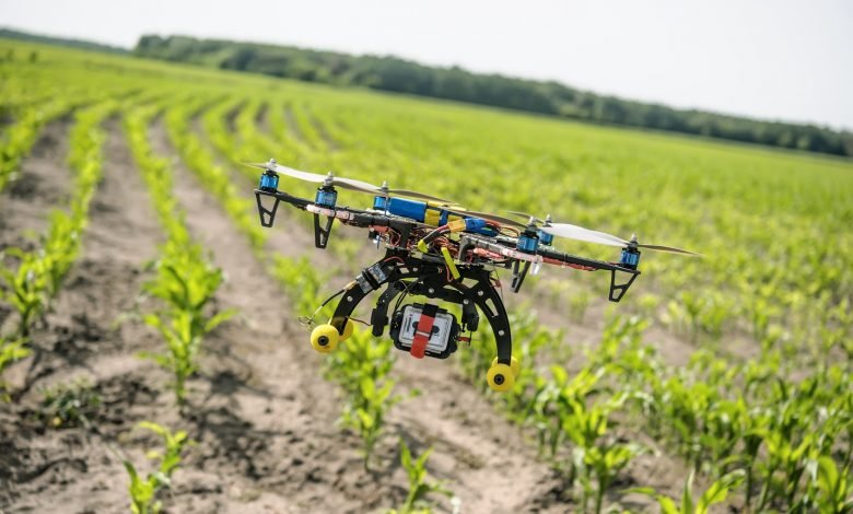
Our client decided to use drones for crop monitoring and UAV mapping to collect field images of trial plots. Satellite images did not provide the required accuracy because cloud cover reduced their quality, making them useful only as an additional source of data.
The BitsByteSoft team started by developing a prototype of drone farming web application, outlining its business logic and gradually moving to user interface design and frontend development. The crop scouting solution allows aerial data collection of trial plots to investigate crop conditions and homogeneity, getting around the issue of cloud obstruction with satellite observations. Users can access crop inventory software and easily add new trial descriptions including names, crops, products, and sowing dates as well as all plot details including width, length, and repetitions.
After collecting images from fields, drones transmit data via an internet connection or automatically store data and deliver it to farmers in the case of poor connectivity with crop analysis software. Once data has been uploaded, the crop scout software can analyze drone imagery according to a wide range of parameters including crop variety, yield, type of pesticide or herbicide, etc.
The farm crop monitoring software conducts a thorough assessment based on trial data and matches drone photos with additional satellite images. Finally, the crop inventory solution saves the assessment in an appropriate format, overlays it on the field map as an additional layer, and uploads results to another Ag crop scouting app with a huge database to compare results and predict growth.
Business outcome
The drone imagery analysis app is just one of several crop inventory database development projects we run for our client. After a successful showcase of this drone farming app, our client is ready to start developing a fully working solution for farmers, and our BitsByteSoft team is ready to support them with crop scouting app development.
Automated collection of trial plot images using drones for farming is a key differentiator for our client. It and makes crop monitoring using drones lucrative for customers due to cost and time savings. Accelerated development of the prototype app thanks to BitsByteSoft R&D services has already given our client a competitive edge compared to other agricultural companies who rely only on in-house engineering capacity. The next step is to scale the drone imagery solution to provide full functionality and deliver it to farmers and growers worldwide.

Let’s work together on your
next project
Drop us a line about your project at contact@bitsbytesoft.com or via the contact form below with attachments, and we will contact you within a business day.