Case Study
Weather Prediction and Disaster Management Using GIS
We’ve developed weather prediction and disaster management software using GIS for station installed across the remote areas
About our client
Forest Technology Systems (FTS) is a leading OEM provider of remote environment and weather monitoring solutions for extreme locations. The company’s range of products includes hardware stations to collect data from hard-to-access areas and online systems to make collected data marketable for the fields of hydrology, fire weather, disaster mitigation, and meteorology. Our client provides equipment and software for the world’s most sophisticated and demanding natural disaster information systems. Its mission is to help end customers successfully monitor, record, and analyze changes in the natural environment via remote communications and remote data collection.
FTS stations are used by all of the top 50 government forest management agencies in the United States and Canada. Every day, FTS products protect locations from the dangerous consequences of fire, flood, and other severe weather events by providing data to inform the planning of environmental initiatives. Customers include government agencies at all levels in the United States, Canada, Mexico, and South America.
Key features

Connect remotely to stantions via GSM and satellite

Collect data for disaster management using GIS

Predict weather based on the collected data
Industry: Environment Monitoring, Disaster Management
Headquarters: Victoria, British Columbia
Market: Canada, United States, Mexico, South America
Team size: 7 engineers
Cooperation: September 2013 – March 2016
Technologies:
Apache 2 / C++ / Checkstyle / EclEmma / Google Maps API / Guava / HTML / JaCoCo / JavaScript / Maven 3 / MySQL 5 / PHP 5 / Spring Tool Suite / SQL / TestNG / Tomcat
FTS came with the challenge
Our client’s hardware stations were already installed in extreme areas to collect data about potential hazards related to severe weather. The next step was to land all this data in one place and make it easily accessible to customers so they could visualize, measure, and analyze data using location technologies to see potential threats. FTS needed a SaaS solution to make their collected data marketable for distribution to governments and other institutions worked on weather monitoring and disaster management using GIS. For this, our client needed to develop a user-friendly web portal with a mobile extension including a billing system to pay for this extremely valuable data that cannot be collected from remote areas by means other than their own disaster mitigation tools.
In addition, FTS needed to improve its hardware stations by making it possible to set up, control, and update them remotely. Previously, our client had to send specialists by helicopter (to the Grand Canyon, for example) simply to install new firmware at a station. This is very expensive. FTS needed a modern API and a reliable protocol for safe remote connections to their stations.
Our client started building a natural disaster monitor with their in-house team based on satellite connectivity to transfer data from stations, but this resulted in very high prices – approximately $1000 per kilobyte. They eventually came to the conclusion that a GSM module would lower the cost of data transfer. After changing their approach to data collection, their engineering team was able to speed up the development process. Still, they were behind schedule. FTS started searching for experienced web developers who might deliver their solutions faster. They came to BitsByteSoft for team extension to develop a natural disaster information system for data operations and remote control.
BitsByteSoft developed the solution
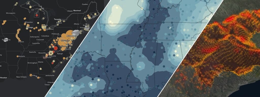
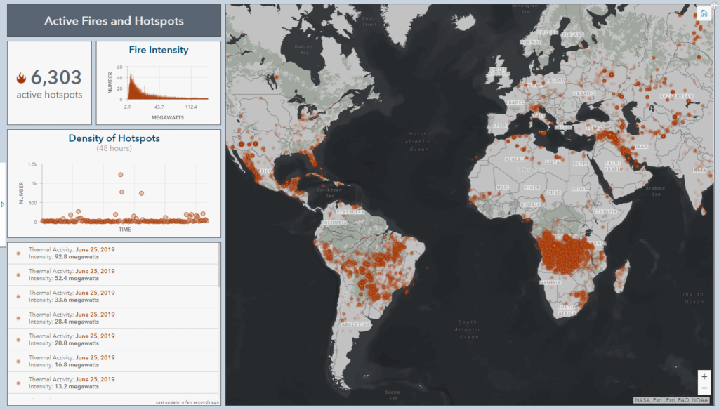
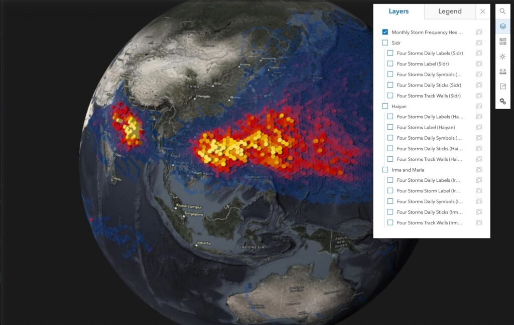
Together with our client’s in-house architects, we started implementing disaster mitigation tools for stations based on Panorama 2.0. Using these tools, natural disaster monitor supply every user with detailed information about stations allows filtering and sorting of options, and supports four languages. The natural disaster information system we developed uses a gateway to interact with monitoring devices via satellite and cellular channels. It collects information from a device’s sensors, changes configurations, browses files on a device’s file system, and upgrades firmware remotely.
For our client, the most advantageous feature of this natural disaster monitor is the ability to make all collected data marketable and use it in applications for weather prediction. As for users, they’re now able to log into the system with a user-friendly web API, search for the most relevant location with an installed station, choose a timeframe for data collection, and then pay for the data they want.
Our solution empowered FTS and their customers with:
- A cloud-based system for data management
- Intelligent analytics for disaster management using GIS technology
- A storage-based marketplace to sell, exchange, and monitor data for further weather prediction
- Exact locations of risk areas for environmental planning
- Dashboards to visualize collected data and improve decision-making
- Improved business processes thanks to easy sharing of valuable assets
- Remote access to stations, thereby avoiding travel to dangerous areas
We achieved great results together
After combining efforts with BitsByteSoft, Forest Technology Systems was able to meet its deadline and build a system for disaster management using GIS as planned. This system already had stations in place to collect data from dangerous areas, and to this base, we added user-friendly web-based disaster mitigation tools to get that data into the hands of customers. We helped to improve the user experience, increase the value delivered to customers by FTS hardware stations, and widen the possibilities for remotely working with these stations. Additionally, we provided several proofs-of-concept to improve data visualization for near real-time response to weather changes. We managed to create a natural disaster monitor, which is marketable and unique thanks to its all-in-one concept that includes both hardware stations with sensors and software to deliver collected data to customers.
Here are the most distinctive features of this product:
- Extremely remote deployments
- Earth-based stations at critical environmental points (areas prone to flooding and fire and other unstable meteorological areas)
- Registers measurable data about potential weather risks
- Extra-valuable data transmission through satellite, plus GSM to the cloud
- Cloud-based web platform to receive and store data for disaster management using GIS (GOES)

Let’s work together on your
next project
Drop us a line about your project at contact@bitsbytesoft.com or via the contact form below with attachments, and we will contact you within a business day.